Active Fire Notification
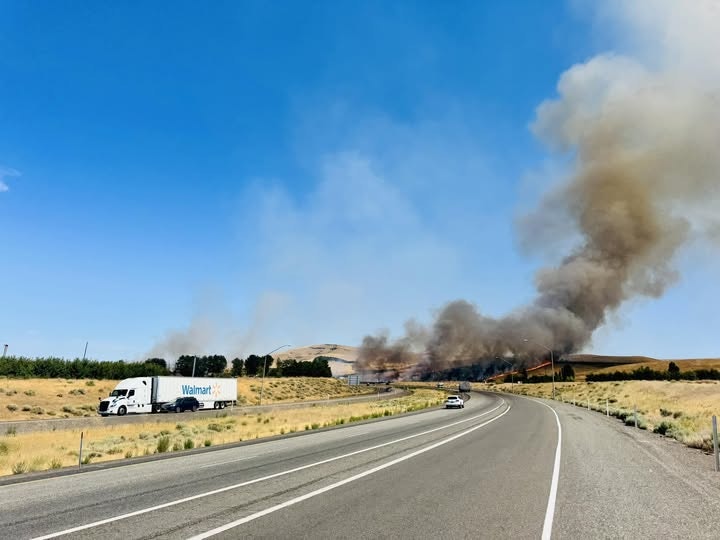
Live Natural Cover Fire – I-82 and SR 221 🔥
Date: July 29, 2025
Incident Name: Sales Yard Fire
Current Status (Updated 7/29/25 – 6:00 PM):
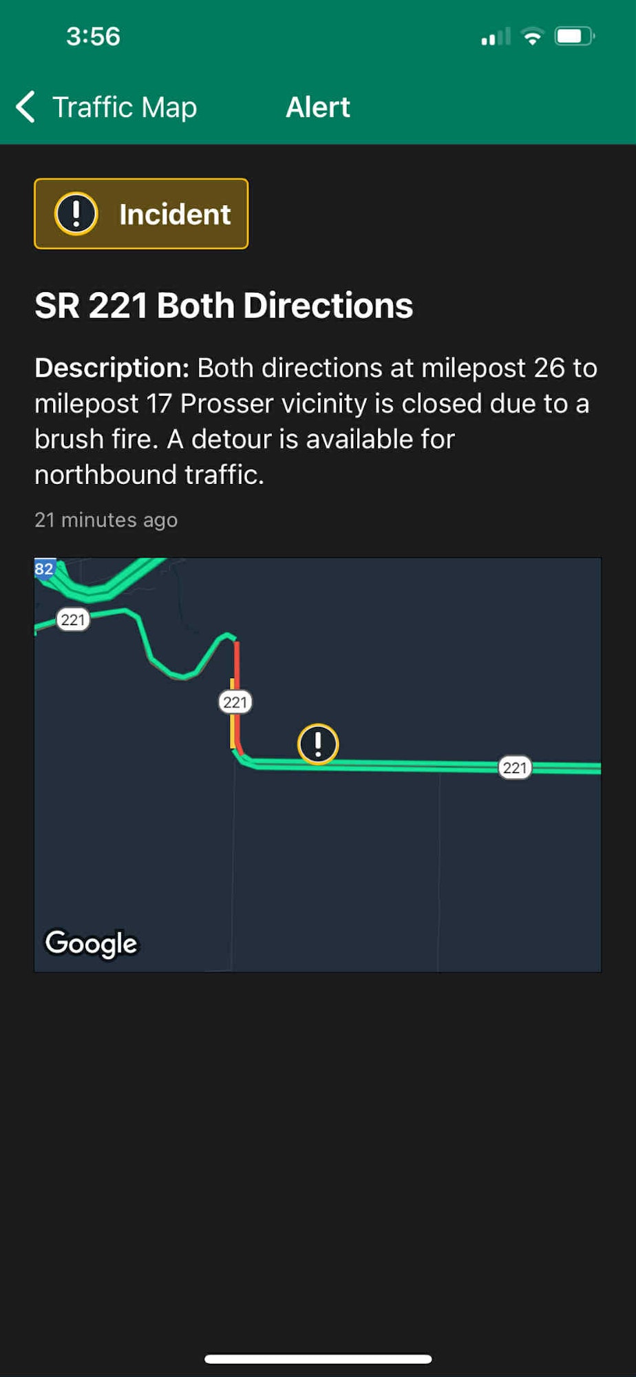
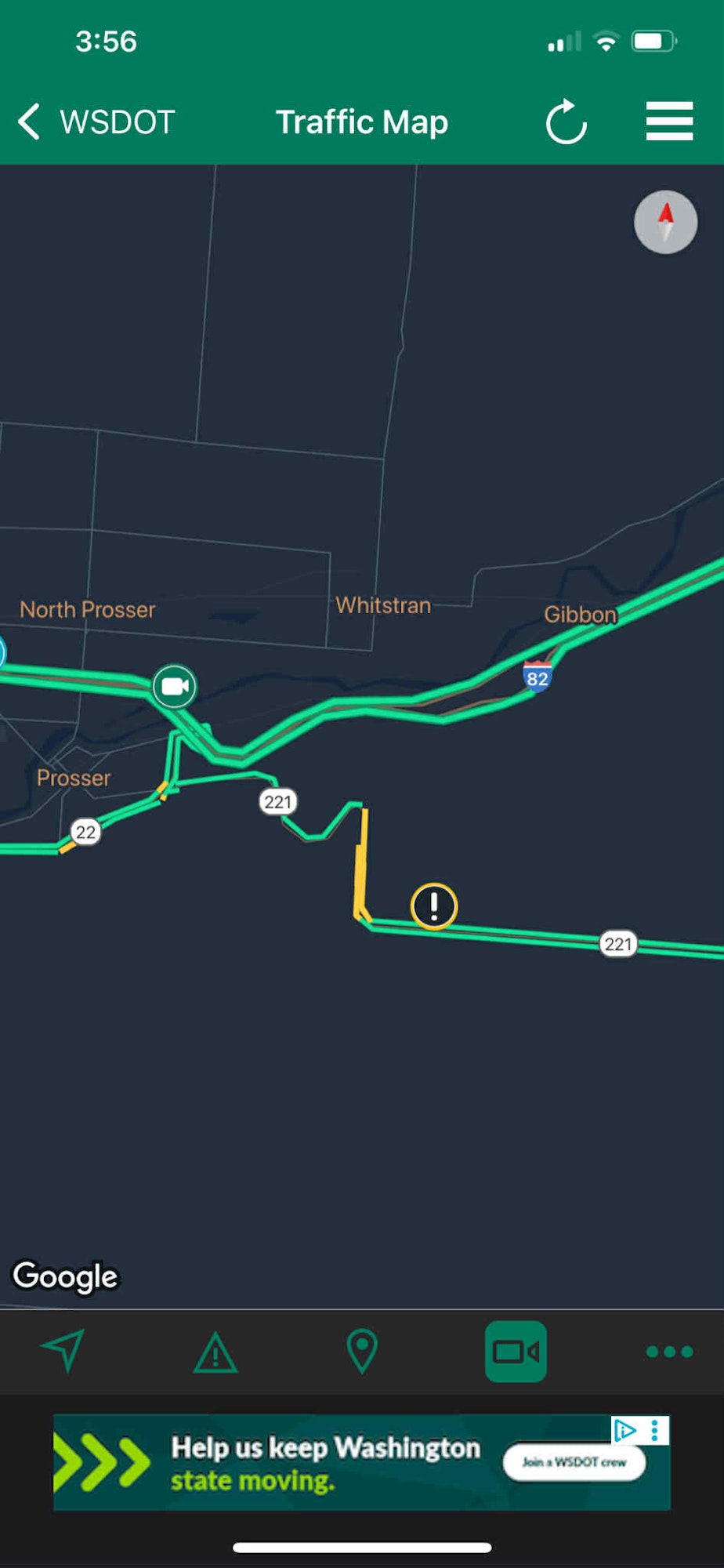
- The Sales Yard Fire continues to impact areas along I-82 from Prosser to Gibbon Road and SR 221.
- SR 221 remains closed, and traffic on I-82 between Gibbon Road and Wine Country Road is experiencing significant slowdowns due to active firefighting operations along the roadway.
-
Multiple agencies are actively engaged in the response, including:
- Richland Fire
- West Benton Fire & Rescue
- Benton County Fire Districts 1, 2, 4, and 5
- Walla Walla County Fire District 5
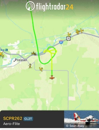
- Air support is underway, with helicopters and fixed-wing aircraft transporting water from sources as far as Richland.
⚠️ Please stay clear of all impacted roadways and water access points for your safety and the safety of emergency crews.
_____________________________
Current Status (Updated 7/29/25 – 5:00 PM):
- SR 221 remains closed due to ongoing fire activity.
- Fire crews are actively working along I-82 from Prosser to Gibbon Road.
- Air support is active, with helicopters and planes sourcing water as far as Richland.
⚠️ Public Safety Notice
Please avoid the affected areas — including roadways and water sources — to allow emergency crews to operate safely and efficiently.
📢 For the most current updates, please visit our Facebook page where we are posting real-time information as it becomes available.
We appreciate your cooperation and support as we work to contain this fire and protect our community.
🔗 Additional Public Information Resources
For updated and live informaiton, please refer to the following sources:
-
WSDOT Traffic
For the latest road closures, traffic delays, and detours across Washington State.
wsdot.com/travel/real-time/ -
FlightRadar24
To view live air support activity in the area during fire operations.
flightradar24.com